Water-column observing systems
Ocean Sensor Chains
Measure changing conditions through the water column from a GNSS-tracked surface platform with satellite telemetry and sensors positioned at selected depths.
Pacific Gyre designs the float, tether, sensor interfaces, power system, telemetry, and cloud data workflow as one integrated observing system. IMM inductive communication is our most commonly used sensor-chain interface and our usual starting point for integrating oceanographic instruments.
Qualified configurations with tether lengths to 200 meters · IMM inductive communication · Native IMM instruments and custom interface pods · 1-Wire® alternatives · Iridium telemetry and GNSS positioning

Designed around the measurement plan
A sensor chain is a complete system—not a single off-the-shelf instrument
The useful configuration depends on the variables, sensor depths, operating environment, deployment method, duration, sampling interval, telemetry plan, and recovery strategy.
Pacific Gyre can evaluate instruments with native IMM interfaces and integrate compatible OEM or customer-supplied sensors through custom IMM interface pods. IMM is generally the better starting point for sensors with neither a native IMM nor a native 1-Wire® interface. Native and engineered 1-Wire nodes remain available for suitable applications. Sensors are positioned at application-specific depths, with observations delivered through the same platform used for positioning and system management.
Depths to 200 m in qualified systems
Position sensors along a configurable tether to resolve vertical structure. Achievable length depends on the architecture, node count, cable characteristics, power, and sampling plan.
IMM inductive communication
Communicate through the tether strength member using compatible native IMM instruments or Pacific Gyre interface pods. Custom integration is evaluated against sensor, power, bandwidth, and tether requirements.
Flexible sensor integration
Combine temperature, pressure, conductivity, current, optical, imaging, and other compatible measurements.
Remote data access
Use GNSS positioning, Iridium telemetry, and Pacific Gyre data services to follow the system and access observations.
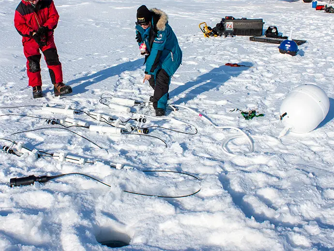
Surface platform and tether
Engineer the mechanical and electronic system together
The surface float provides buoyancy and houses positioning, telemetry, control electronics, and power. The tether carries the sensor array and its communication path.
- 16- and 18-inch surface-float configurations
- Qualified tether configurations to 200 meters, with achievable length determined by architecture, node count, cable characteristics, power, and sampling requirements
- Replaceable or long-duration battery configurations
- Optional hull-mounted temperature, conductivity, and atmospheric-pressure measurements
- Manual and application-specific air-deployment rigging options
Available options depend on float size, sensor load, deployment method, reporting interval, and required operating life.
IMM sensor-chain interfaces
Inductive communication, built around your instruments
IMM is Pacific Gyre’s most commonly used sensor-chain interface. Instrument communication travels through the tether strength member, avoiding separate small-gauge signal wires along the chain.
Use instruments with a compatible native inductive interface, or work with Pacific Gyre to integrate other sensors through an IMM interface pod. For sensors with neither native IMM nor native 1-Wire® communication, IMM is generally the better integration starting point. The final design depends on sensor count, power requirements, data volume, sampling timing, and tether configuration.
| IMM integration path | Best suited for | Design approach |
|---|---|---|
| Compatible native IMM instruments | Oceanographic instruments with an integrated, compatible inductive communication interface | Review instrument compatibility, addressing, sampling, power, tether arrangement, and data handling as part of the complete system. |
| Pacific Gyre IMM interface pods | Selected OEM and customer-supplied sensors without a native IMM interface, including sensors with neither IMM nor 1-Wire | Engineer the sensor connection, interface electronics, firmware, power, and underwater packaging. Every custom integration begins with a Pacific Gyre engineering review before a configuration is proposed or quoted. |
Sensor integration and engineering review
Custom IMM interface-pod and bridge-based 1-Wire® systems begin with an engineering conversation. Before proposing or quoting a configuration, we review the sensor protocol, supply voltage, startup and average power, data volume, sampling timing, tether length and topology, environmental packaging, test requirements, and fault behavior.
Electrical and cable requirements are evaluated for the selected architecture, including cable capacitance for 1-Wire designs and the inductive communication path for IMM systems. An interface pod or bridge device enables integration; it does not make every sensor suitable for a long marine sensor chain. Tether lengths to 200 meters apply to qualified configurations and depend on architecture, node count, cable characteristics, power, and sampling requirements.
1-Wire® as an alternative
1-Wire is well suited to distributed, relatively low-bandwidth measurements using native devices or qualified Pacific Gyre modules. Individually addressed nodes share a common bus to the surface controller.
Selected non-native sensors, including potentially compatible analog, digital, I²C, or SPI devices, may be supported through engineered bridge nodes. Every bridge-based 1-Wire chain begins with a Pacific Gyre engineering review before a configuration is proposed or quoted. Interface, power, timing, data volume, tether topology, and cable capacitance must all be supported by the design.
Integrated measurements
Build the vertical array around the scientific question
Compatible native IMM instruments and sensors integrated through Pacific Gyre IMM interface pods can be combined with measurements on the surface float. 1-Wire® configurations are also available when suited to the measurement plan.
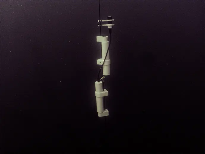
Physical water properties
Measure temperature, pressure, conductivity, and salinity at selected levels to observe stratification and change over time.
Currents and optical conditions
Integrate compatible current meters, optical instruments, and radiometers when the study requires more than temperature and salinity. IMM is our usual starting point for these OEM instruments, using a compatible native interface or an engineered interface pod.
Past integrations include Sea-Bird and Soundnine CT/CTD instruments, Aquadopp current meters, and hyperspectral radiometers.
Imaging and custom payloads
Add compatible underwater cameras or customer-supplied instruments when power, communication, and mechanical requirements can be supported.
Integration work can include mounting, cabling, communications, data parsing, testing, and deployment preparation.
Telemetry and data services
Follow the platform and the water column from shore
Iridium SBD provides global two-way communication for positions, system status, and sensor observations.
Use Pacific Gyre data services to review tracks and measurements, download archived observations, and connect data to external systems through an API. Supported configurations can also accept remote changes to sampling or reporting settings.
Explore data services Discuss data requirements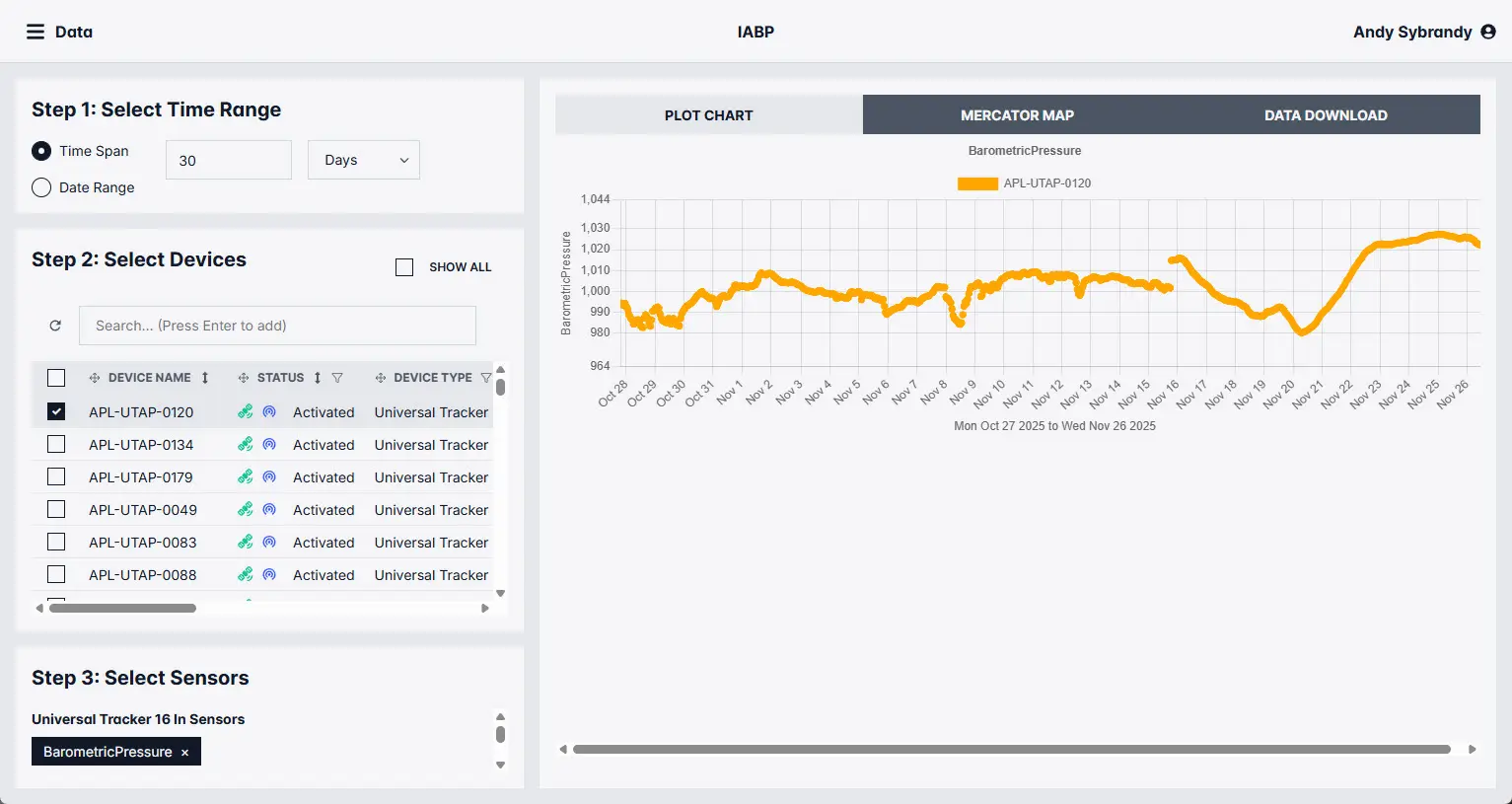
Applications
Observe vertical structure where fixed infrastructure is impractical
Upper-ocean structure
Resolve temperature, salinity, pressure, and other changes across selected depth levels.
Polar and under-ice programs
Collect remote observations through long deployments in regions that are difficult to revisit.
Drifting process studies
Measure water-column conditions along the moving trajectory of the surface platform.
Multidisciplinary observing
Combine physical, optical, current, and imaging observations in a coordinated system.
System planning
Define the system before selecting the parts
A short set of decisions establishes the float, tether, sensors, power, telemetry, and deployment configuration.
Define the objective
Identify the process, required variables, accuracy, sampling interval, and decisions the data will support.
Set sensor depths
Specify the water depth, chain length, vertical spacing, and whether surface measurements are also needed.
Choose the instruments
Match sensor type and communication architecture to power, bandwidth, calibration, and mechanical constraints.
Plan deployment and data
Set mission duration, deployment method, reporting interval, recovery plan, and data-delivery workflow.
Start with what you need to measure
Tell us your sensor models, operating environment, desired variables and depths, sampling rates, deployment method, duration, and reporting needs. Custom IMM interface-pod and bridge-based 1-Wire integrations begin with a Pacific Gyre engineering review.